I had originally planned to do the Leslie-Karamea track and then take the Wangapeka track to Rolling River but the transport costs turned out to be prohibitively expensive – $200+ at each end! For that I could fly to Auckland direct from Hokitika and still have money to spend on a new party frock. I decided instead to make a loop from Baton Valley.
By popular demand here is a photo of all my food:

Why do people like these photos so much? My Stewart Island one is the most popular photo on the blog???
On the left I have my lunch (wraps and salami), breakfast (muesli), seasonings (cheese, salt and pepper), electrolyte, milk, and protein powders, a sample pack of some amino powder, and my luxury – Bumper bars. The other food is divided up in to day lots – one organic Honey Stinger waffle (I got them cheap because they were endorsed by Lance Armstrong – if there are two things that are mutually exclusive they are “organic” and “Lance Armstrong’s performance source”) and 2 muesli bars per day, one dinner, a jerky bar, and some sort of dessert. One of them is some powdered egg.
The drive in from Tapawera takes about 45 min on 13km of unsealed road. My little car sits very low so I had to take it slowly. At the road end there is a gate, and that’s where the track starts.

You could possibly park in here if you obtained permission from the landowner.
Immediately the track crosses a ford. No chance of dry boots!

No avoiding this.
On the other side head right (not towards the house). The track follows a 4WD track for a while.

About 30 min
It then heads in to the bush and crosses the border of Kahurangi National Park. After that it becomes a proper tramping track.

Still a reasonable track.
The track is well marked and where it is on land it is generally reasonably benched. However it crosses the river a lot.

Like here, where it goes along the side of the river

The first major crossing

And again
Although I did the track mid-January the water was quite high and only just suitable for doing solo. I wouldn’t want to do this when the water was any higher. As a gauge the river was never quite high enough for me to get wet undies.
After the intersection with Loveridge track the track ascends on the other side of the valley. I don’t think the map is quite right because it shows ascents of 80m – there was nothing near this.

Just gradual ascents
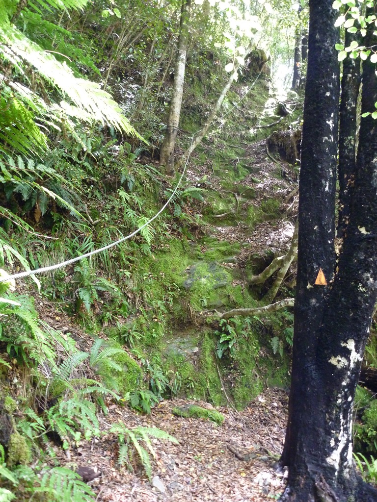
But there was this
I do find the placement of cables on tracks a bit random. Here there were a few sections as precarious as this but only this one had a cable. That said, I did not mind it being there.

Then more river crossing
Note that it looks quite shallow here – don’t be fooled – the far side has quite a deep trench. But once again, not quite enough for wet undies.

Pretty scenery!
There’s a bit more ascending, and one more river crossing. But then!

About 1.5km out

Then there’s this
I don’t know if the bottom carving is to designate a hut, or some sort of mathematical scavenger hunt.
It took me 5 1/2 hours to reach the hut.

Flanagan’s hut
It’s a nifty little hut that sleeps 8. There is a wood stove but no running water.

20m from the hut
I decided to make use of this and have a wash – but it’s very cold! Fortunately there was plenty of sun.

View from the hut
I wondered why there had only been about 20 visitors per year to such a nice little hut. The next day I found out while crossing the Baton Saddle.

The objective
The track goes up a marshy valley and while the track is well marked it is not cut at all. Combine this with speargrass and the going was slow.

Speargrass flowers have spikes rather than petals.
Whenever I go to Hunting and Fishing stores I look longingly at the racks of Bear Grylls-branded machetes, but then think, ‘No, I don’t need one – I’m not planning on doing any bushbashing ever again’. Ha! I would have killed to have a machete on this track.

Not only overgrown, but also steep.
On this section it was almost entirely hands and knees. I was pulling myself up by the tussock, trying to avoid grabbing a stem of speargrass (not always successfully). Anyone that thinks tramping is not a full-body workout has never tried a proper tramp.

Looking back down the valley
The grade eases off a little and it’s a bit easier once the vegetation this out. But then the weather closed in.

Still going!
After 2 hours I reached the saddle.

Just in time to catch the view!

This cloud came over literally as I reached the top
On the other side the track heads straight down. There are some trampers who somehow can somehow pull off elegance in the bush – wearing checked shirts and trousers and dabbing the perspiration from their brow with a small microfibre cloth. I am not one of those people. So if you do this track, you will see a rather large strip of the hillside cleared of vegetation where I just blasted a beeline between one snow pole and the next, rather than zig-zag down the hill.

The track then heads in to the bush

Ooh, look at how old that permolat is!
Once in the bush there is a steep descent. I don’t know if it was my lack of coordination or the condition of the track but I fell over here a LOT.

Photo does not show the steepness adequately
There are a couple of sections where the track has been redirected around fallen trees. These are marked with the pink ties usually used to mark possum traps. In this case just follow any markers.

Looking back up at one of the redirections. Fog due to condensation on camera lens.
The track breaks out of the bush a bit and goes over rocks. I thought this would mean easier grip but no! The rocks are slippery.

Especially fun when the only handholds are bush lawyer and stinging nettle. Note here just how much nettle there is.

Common scene on this section.
There are also a lot of wasps here. I thought at the time it was nature’s way of saying, ‘Get the hell out!’

There was a least one bit of scenery
The last section of the track is overgrown with cutty grass.

Plenty of obscured foot traps
After 5 hours I made it to the track junction.

Note the sign calls it a route – it is called a track on the map
This is the very definition of a route – the track is hardly cut at all – the markers just give you a route to follow.
I headed up the Leslie track. Normally I dislike such boring highway-like tracks but after 5 hours of slog I did not mind AT ALL.

Oooh flat

Oooh scenery

Oooh more scenery

Oooh pretty campsite
Just after this campsite is an old Forest Service sign with times and distances

It may not show up in this photo but some of the times have been scratched to be lengthened – to make it to Karamea Bend hut from this point in 2 hours would require some serious speed.
After this point the track ascends. It’s well graded but took me a while due to being completely unavailable.

Typical section of track
It took me 2 1/2 hours to make it to Splugeon’s rock shelter from the Wilkinson junction.

Splugeon’s shelter
This is another very nifty accommodation.

Inside
The DOC website says it sleeps 2 but this is not correct. It just means it only has 2 clean mattresses (see photo). You could fit 5 people in here.

A very pioneering setup.
Once again no running water – 30m from the hut is a small stream.

It may dry up after a period of sustained dry weather
I would recommend filling up all the billies while you still have your boots on – the water access is a bit difficult and slippery.

View from the hut
After a lovely night all alone I awoke the next day to more damp weather – not rain, just damp. The track continued its graded ascent.

More of this
Eventually the bush starts thinning

to this
And there are some views

During a break in the cloud
The track breaks out of the bush and goes over tussock plains

Like here, where the next snow pole was not visible. Just go straight ahead.
After a junction the track starts heading down towards Salisbury lodge. I had some luck with the cloud clearing so I could have some views.

Track conditions
After 2 hours I made it to Salisbury Lodge.

Note world’s flashest hut toilet on right – solar powered lighting!
I arrived at 10.37 and 2 groups were only just leaving. What do people do in the mornings???
This hut is a day walk from several entrances and is very popular. It has all the mod-cons – running water, coal burner, gas cooking. I used the gas stove to test out my powdered egg (Ova Easy) for lunch.

With salami!
Very good, and unfortunately also very expensive.
Near the hut is a section nicknamed the Potholes.

Quite Hobbit-like
The potholes themselves are varied.

How cool!

How boring!
There is a cave system near Sphinx Rock.

No longer Sphinx-like after an earthquake.
I followed the stream to the end, but the cave there is uninteresting.

Meh.
There is another cave a bit further back but I did not go in to it.

Apparently it has stalactites and things.

Looking back up the stream
I returned to the hut. Apres moi, le deluge. About 15 people showed up. The are allowed to come tramping, of course, but I go in to the bush to get away from people. I managed to do some work but there was so much noise I could barely read the trash fiction that someone had left in the hut. Add in to that the headtorches. I HATE HEADTORCHES. Firstly, when the moon is out there’s actually enough light for you to see what you need to to get in to bed without a light. Secondly, if you do for some reason need a light to see where your legs are the TRY TO AVOID HIGH BEAMING THE REST OF THE HUT IN THE FACE!! I was just asleep, and then 3 people went to bed at 11pm, high-beamed everyone (who needs a 1W headlamp to get in to bed? It’s not like you’re performing microsurgery) and I couldn’t get to sleep again. I hate people.
The next day the cloud cleared.

Huzzah! The objective: Gordon’s Pyramid
The track cuts across the tussock.

Looking back from the bushline
In the bush the track is a bit muddy but not bad.

Not bad
The ascent is up a root staircase

Tiring, but not exhausting
You soon get a scenic payoff

Oooh
But there’s still more to go

Its quite easy – just one foot in front of the other.
Note however that the rocks at the top are a false crest – so don’t get too excited. You are at the top when you reach the track junction. It took me 1 1/2 hours from the hut.

Yay!
The scenery is impressive.

Looking back towards the hut

Towards Mt Arthur

The track heads along this ridge

And then out here
The track is very clear and travel is quick.

Until you get to this ascent (on the left)

More or less straight up
The next section was probably the best part of the whole trip – the landscape is full of cool rock formations.

Neat!

Horseshoe Valley
The track undulates then continues climbing.

Looking back towards Gordon’s Pyramid.
After 3 1/2 hours I made it to the junction that goes down to Mt Arthur Hut. I took the other track towards Mt Arthur.

On the other side of the ridge you can just see the sea
It’s more ridge travel and becomes rockier as it ascends.

View from my lunch spot.
However the weather started closing in and it became sleety.

The weather did make the rocks look more dramatic

But high winds did not make this traverse more fun.
I decided against going for the summit, mainly because it was cloudy an I wouldn’t have a view. And it stayed in cloud the rest of the day.

The track to Ellis basin heads down this ridge

Mt Arthur in cloud. I was right!

View in to next valley
The ridge travel is fine, but then there is a very steep descent.

The first section is fairly well zig-zagged, but is steep nonetheless.

Looking back up

Look at the view across the valley!!
Once out of the rocks the descent is just as steep but with the added excitement of slippery tussock. You could slide down it on your bum if you don’t mind the risks of occasional rocks, speargrass, or fatal dropoffs.

I just took it slowly.

That view doesn’t get old
Eventually I made it to the bottom (1 hour 40 minutes from the turnoff at Mt Arthur). Just in time – it poured down 15min after I arrived.

Another super little hut
Ellis Hut sleeps 6 and has an open fire. One of the window louvres has been replaced with a piece of cardboard. Once again it eschews the capitalist decadence of running water, instead having a stream 50m away. It does however need a table.
I wondered why the hut book was only half full after 6 years.

Look at the view!
The next morning I couldn’t figure it out – the track was steep but mostly root staircase in reasonable condition.

Just straight down the ridge.
At the bottom there is a river crossing. I didn’t pick up the track marker on the other side and rather than backtracking just thought I’d streambash and pick it up at the next one. Ha!

Starts well enough
And I did wonder if this was commonly done – I saw occasional boot prints and track markers.

Like this spraypainted rock
However the water level became higher and the boulders became bigger. A few times I had to bushbash around them. One descent was particularly inelegant.

That’s one way to get it done.
The only payoff was seeing this big rock wall.

Hmm!
2 hours to go 2km later and I was VERY glad to see the next track marker – so glad that I didn’t check which way I should be going, and immediately headed up 100m of ascent that I didn’t need to.

Vroom!
15min up, 20 min down, and then back to the track. It crosses the river several times.

This is not a cable on the other side – just a particularly handy (and strong!) root.
It’s not particularly bad, but is just slow going.

More crossing

Track condition
About 1.5km from the road end the track goes in to grassland. There are a few marshy patches.

but it’s otherwise ok.
Eventually it gets to the 4WD track, and from there it’s 1.75km to the finish. Yay! It took me 7 hours including 2 hours of messing about in the river, which would have taken about 45 min if I’d taken the track.
If I were to do this again I’d only do the Mt Arthur-Gordon’s Pyramid area – that’s where the scenery is best and the track is in the best condition. However, it is also the busiest. If you do want a secluded hut then Flanagan’s and Ellis are certainly that.

I absolutely love this trip report! Thank you for being so comprehensive!
This was great reading and very helpful as we are considering doing the same! Thank you so much for all your detailed and descriptive info