Given that I had a whole month on holiday and no army work I decided to undertake the longest tramp I could find. At 125 km the North West Circuit on Stewart Island is NZ’s longest so I took out all my gucci kit and did some shopping.
With some creative packing I flew down to Invercargill at the start of January. I stayed one night at Tuatara backpackers ($8 for the airport shuttle!!!) and it was clean and comfortable.
The next day I took the ferry to Stewart Island. The ferry charge of $78 included a shuttle to Bluff. You get dropped off about 30min before the ferry leaves so be prepared for a wait. The crossing was ok and only 1 hr but if you are prone to seasickness fly across, as it is open sea.
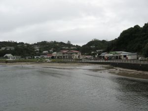
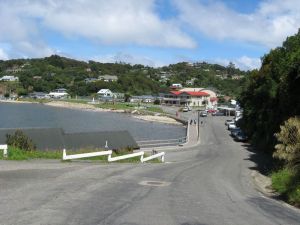
I arrived in Oban (the sole village on the island) and it was raining. If this happens to you make sure you pick your bags up quickly because the ferry luggage containers are not covered.
There is a decent 4 Square and just about everyone has eftpos so ignore scare stories about everyone only accepting cash. You need to check in with DOC if you are doing the circuit and you can hire a locator beacon and storage lockers there. The DOC office is on Main Rd and is easy to spot. I was using the 1999 topomap and the track has changed a bit since then. The DOC officer will annotate your map if needed.
I then set off (in the rain) down the road to the start of the track at Fern Gully (I went clockwise). The powerlines were all covered by woodpigeons perching on them. The start of the track is an old logging road so is about 6 lanes wide and metalled. It narrows after a few km but is mostly boardwalk with a few mud patches. The walk to North Arm Hut took about 3.5 hrs. North Arm is on the Rakiura track (a Great Walk) so it was FULL. All the hut book entries were about fish and chips which was not a good way to start. Fortunately I had steak for that dinner.
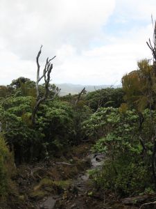
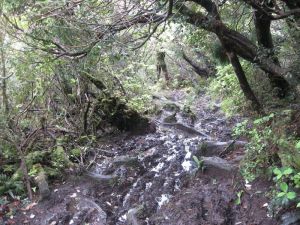
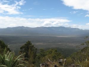
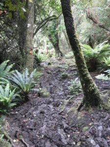
The next day continued on the great walk track for about 1km then turned off to the North West Circuit. It goes from boardwalk to MUD immediately and continues this way until Port William. Not quite, but almost. The crossing of Thomson Ridge is a steep one and when you get to the top the view is:
The reward for scrabbling up to the top is a short section of boardwalk followed by a steam bash followed by THE SOMME!
The track then turns in to a nicely graded and almost dry path back down to nearly sea level, and continues to Freshwater hut with a few mud holes and stream crossings. I arrived at Freshwater after 6 hours and it was empty. However at 4 pm it was suddenly full as a family that had come from Mason Bay moved in. They took the 5.30 water taxi out and all the water taxi people moved in so the hut finished up nearly full (12 people).
I had my first go at pancakes here. I was using Edmond’s wholemeal pancake mix because it didn’t need anything (milk, eggs, etc) and was at the expired food shop for $2. I used 1/3 of the mix and tried using a nonstick liner for my dixies. However, the dixies (that I have had teflon coated) were actually more nonstick.
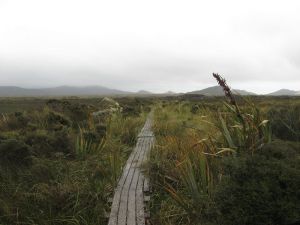
The next section starts with quite a bit of mud, then is mostly boardwalk. A pair of walkers who left an hour after I did said they saw a kiwi on this section of the track. I was having tendon problems so just pushed on with tunnel vision. The track is practically flat so it took 3.5hours. It’s quite desolate in comparison to the rest of the track.
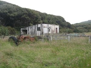
The section near the beach used to be a farm and you will see many old fences and the old farm buildings.
There is also a hunter’s camp a few km from the hut.
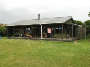
Mason Bay hut is quite new and large. Many people fly in to the beach, walk the flat section and get the water taxi out, and some people take day trips for kiwi spotting. I was the only NW circuit tramper out of the 20 people in the hut.
I had quite a bit of time and the fire had a nice bed of embers so this suited my first cake quite well. I used 1/3 of a packet of Edmond’s Orange Poppyseed cake mix with 2t instant pudding as an egg replacer. On reflection I think it would have been better with a homemade mix because the Edmond’s stuff was quite flavourless. However baking a cake in the fire worked! I put everything in an oven bag and put that in my dixies and put the dixies on the embers with some embers on top. 20 min later I had this:
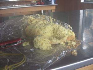 The bottom was burned. Room for improvement!
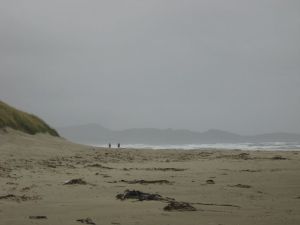
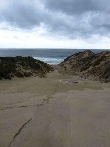
The next day was gloomy and windy, making the beach quite dramatic.
After a few km on firm sand and 2 km over rocks (you may be able to avoid these at low tide) the track goes uphill in the bush. This ascent is MAD. Some sections have ropes because it’s so steep. There isn’t much mud but it is very wet. Once again, the other side is a nicely graded descent with only a few mud holes. The track goes down to the beach then has a slow ascent to 400m and follows a ridgeline. The views here are amazing.
The track then descends in more ways than one. It goes down several hundred metres and goes from a fairly decent track to the maddest mud I had ever seen. You know when you’re almost at the hut when you can’t stand the mud any more. But it’s worth it because Hellfire hut has the best view on the whole track.
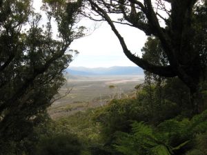 The advantage of doing the track clockwise (when most people go anticlockwise) is that you meet different people every night. Here I met a man who had been alone for the past 7 days. At this hut I heard kiwi but didn’t see any. The hut also had a large supply of old FHM/Ralph magazines.
The next morning it was raining and the track out from the hut turned from Passchendaele to Verdun to the Kokoda track. The rain was worse than a Malaysian monsoon so my raincoat didn’t make much difference. The track goes down to the beach then goes over Ruggedy Saddle.
The crossing isn’t too bad but on the other side it’s like a stream bash. The track has been re-routed to avoid the old inland part that was apparently awful and instead goes back down to the coast. I didn’t actually see the old track but when you get near the beach the track is quite overgrown. After another beach walk you go up a 1 km sand dune. The sand is reasonably firm but it’s still sand.
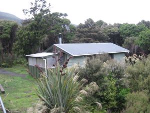
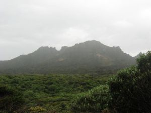
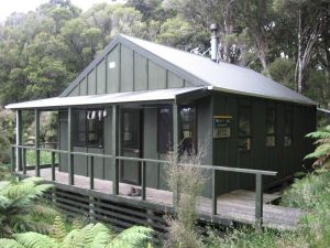
The next few km in to the hut seemed to go on forever but eventually I reached East Ruggedy The Ritz!
This hut seems to be quite well frequented by hunters because it came equipped with 2kg of salt, baking soda, hut shoes and a frying pan. That was fortunate because having eaten all my pita bread (lunches) I had to make my first batch of tortillas. These were quite successful.
Tortillas (makes 6 x 15cm tortillas)
2 c flour
1 t salt
1 t baking powder
1 T oil
1/2 c water (or more, as necessary)
Mix everything and knead to make a reasonably elastic dough. Roll out (I used my mug on my Orikaso plate) and fry on both side until browned. Keep the flame quite low (I had my Coleman stove set to low)
Once again I thought I was alone only to have the hut door fly open at 9.15pm and an extremely smelly Czech burst in. He was doing the track in 5 days, only had bread and cheese and commenced complaining about the track with a high volume of noise and swearing. He was going the same way as I was so I made sure NOT to press on the far hut the next day so as to avoid him. The stench!
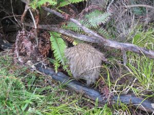
The next day started quite gloomy and had a muddy ascent. I was starting to get depressed about the mud, my tendon, and the fact that I STILL hadn’t seen a kiwi. Then I came over a hill and there it was, on the side of the track!
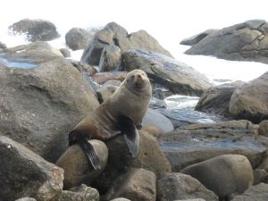
This made my pack about 5kg lighter but I still had to battle the hookgrass down to the beach. This beach was made from large boulders so travel was quite fast. Don’t bother taking the high tide track because it’s just mad and you’d probably stay drier swimming. This beach also has seals.
The track then ascends vertically.
The track rises and descends repeatedly very steeply (+/- 100m) but does have some good views.
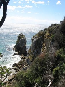 The walk took me 5 hours. Long Harry hut is very new (2003) and apparently has good fishing/mussels if you down to the bay (10min). I was making another cake. This time I tried it on the stove and because it needed to be insulated I found the pump heated up too much to touch, so I ended up taking it off before it was completely done.
The next day was a short one but I found it quite hard. It was raining and although the track wasn’t muddy it was wet and steep. The stream on Smoky beach can be forded but is rib deep. Along this beach I was followed by a dotterel. It was weird. Out of nowhere the track to the hut was metalled!
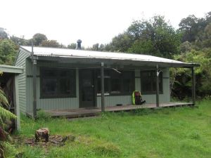 Yankee River hut is quite small but it did have an old copy of the Listener. With the fire going I did manage to dry everything out.
After this point I was on the lee coast and the terrain is noticeably less rugged and the mud is replaced with tree roots in the annoyance stakes. Christmas Village is a lovely spot. The walk took 6 hours.
This meant everyone else was there too, including a group of 17 from a tramping club and a family. Space was cramped to say the least even with some of the tramping club in tents. I spent the whole night guarding my pancakes and tortillas from prying fingers.
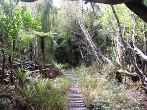
The next section had the standard fare of mud etc. but then hit an old section of tramway. The tracks have gone but the boards remain! I was quite pleased to see it.
 At Bungaree hut (walk 5.5 hrours) I met 3 men who’d just started. It’s quite something to be the ‘old hand’ after 9 days in the bush. I had another crack at cake baking but didn’t build up a good enough bed of embers first. This meant the heat was too low and when I built up the fire the cake burned on one side. It didn’t burn on the bottom because I’d put in a wedge of tinfoil.
I started early the next day to be finished earlier. The mud kept up until the Great Walk turnoff. I’m not kidding. The last km is terrible!
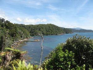
Then you hit 4 lane metalled highway with stairs. The weather was absolutely fine and on the last section the sea was clear enough to see the reefs.
 So after 4 hours I was back on the road. The last few km were a killer! Slowly I came back to civilisation.
10 days after leaving I arrived back in Oban.
After reporting back to DOC I checked in at the backpackers (full) and as I walked around Oban I met all the people I’d seen on the track. I booked a flight back to Invercargill since it was $90 (rather than $175 like they told me in Invercargill). The bush was full of tuis and kakas that would swoop in packs of up to 5. The museum is quite small and takes 30 min max to look at. I didn’t go to Ulva Island because I was birded out.
Now the after action review!
Gear:
I used jungle boots with Formthotic insoles. These worked well for the mud but I did get heel problems.
There are rumours that you need 2 sets of gaiters. This isn’t the case. The mud never went over my tall gaiters.
A pack cover is essential for mudproofing and to keep your pack dry (saves weight)
I used 2 tanks of fuel exactly for my Coleman stove.
You can bring an emergency shelter but I don’t think the huts will ever get full enough to warrant bringing a tent ‘just in case’.
Reading material is essential – 500 pages are about right.
Food:
I took 14 days’ worth. I bagged it in daily lots and just about everything was in a ziplock bag. For snacks I had Le Snak (which don’t crush even after 10 days) and carbo shots. I didn’t notice any sugar rush but the chocolate Gu was just about the most delicious thing I’d ever eaten (by day 6).
For starch I had some 3 min macaroni and 1 min noodles (from an Asian supermarket). The noodles were certainly easier to cook. I also brought some cheese mashed potato. The cheese flavour wasn’t flash so I’d get sour cream and chives next time.
For mains I had some Kaweka meals, dehydrated mince and tomato paste, and freeze-dried. The Kawekas were nice but heavy. I noticed when I’d had them out of my pack. The dehydrated mice was great! I’d put some cold water in the bag when I arrived at the hut and by dinner time it was fully hydrated. Heat up with a sachet of tomato paste, put in some noodles and it’s very good. The dehydrated meals were a change but the chunks of meat didn’t rehydrate so well. I did take some fresh pre-grated parmesan and some Spanish seasoning powder. Both were invaluable. By the way, the Coleman salt and pepper shaker LEAKS.
The fancier desserts were good for filling in time and the pancakes were very good. I put Easiyo fruit swirl on them because it doesn’t go off and comes in a resealable sachet.
For lunches I had pita bread for the first 5 days then tortillas, with salami. One big one was about enough. Make sure you get a cold processed salami because these won’t go off, whereas some salamis need refridgeration.
One thing I would definitely recommend is taking electrolyte powder. I took about 500g and had it every night. I never had cramps or woke up with stiff legs. And it tastes good.


Hiya Deb,
You probably won’t remember me but I met you at Long Harry Hut while you were on this tramp. I was the Kiwi guy there, there was as an Israeli guy, a Canadian guy, and an Aussie couple.
Anyway, I just stumbled across this blog via the NZ Tramper website and thought I would say hi. Wasn’t 100% sure I knew who was writing this until you mentioned the Czech guy (I met him the say day I got to Long Harry).
Nice blog. Stewart Island was an awesome tramp. I deffinetly want to go back and next time around I’ll do the Southern Circuit plus go round the NW clockwise like you.
Cheers,
Ian.
Hi Ian,
I do remember you – did you get out early? I met the Israeli (forgotten his name) at Oban, after he’d taken the taxi to get around the flooding.
It was a good tramp – definitely the most physically challenging one I’ve ever done though! Straight after this I did the round Ruapeha one and it was just a walk in the park!
Hey,
The Israeli was called Zvi. It ried to get in touch with him via Facebook afterwards but Zvi is apparently a common name in Israel! I keep in touch with the Canadian though. I went the whole way round to Freshwater with them where they caught the taxi out. I stayed on and walked out to Oban, so yeah I did Oban to Oban like you. We just caught the end of the flooding at Freshwater, the jetty was underwater when we got there, and I tried to push on to go up Rocky Mt that day but the track the other side of Freshwater was completely underwater. I stayed the night and next day the track was dry… crazy change in water volume!
It was the day after Long Harry hut when it rained cats and dogs and there was a thunderstorm that caused the flooding. Dont know what it was like for you going on to Yankee River but for me it was very wet and miserable day. The East Ruggedy stream was in flood and I very nearly had to swim to get across it. Seamed to find all the quicksand in the middle to… fun times being in a swiftly flowing waist deep river with your feet sinking into the sand! Thankfully the weather cleared up and was great for the rest of the trip!
I think for me the Dusky was a harder trip, but I was pretty inexperienced when I did that. The mud was about the same!
Just wanted to say thanks for writing a decent blog of your trip. This will help me prepare for my upcoming doom on the North Western Circuit!
Thanks! Any questions just ask.
Hey, were there any sections on the track that were a bit confusing? Is it a very well marked track?
I am considering doing the North West mid March.
Thanks
Most was quite obvious, except one bit going down to West Ruggedy Beach near North Red Head was quite overgrown. Also the track going east from Long Harry had quite a distance between track markers – I had to retrace my steps here, but that was the only point in the track. The rest of the time the mud shows the track quite clearly!
Hiya,
Keen to do this one sometime this year, and was just wondering. What time of year did you do this to get all that rain? Might be something I might try and avoid. We were thinking of doing it late August, early September. Thanks!
I did it in January. The island is so exposed you can’t guarantee any time will be ok – I know someone who did it in July and it was fine the whole time!
Hi,
I enjoyed your blog and pics. It brought back good memories. I did the circuit in March 1975 with 2 Kiwi farmers when it went right down the Freshwater swamp-my favorite part. My wife and i visited again last month and just wandersed up to Maori Beach on the metaled part. Today the rangers think the freshwater section(now closed) was boring.
the track was not much traveled then, we were alone in 3 huts, and it was not so muddy except the north arm section. the track was shorter and we finished in 5 1/2 days. It was the most satisfying walk I did in NZ. We only had one day of rain, and then not much.
Hi
I’ve done this circuit 6 times. It is so relaxing with the beautiful golden beaches. We really enjoyed meeting people on the circuit too. I’ve done the clock-wise direction twice. It is meant to be easier but I think last time I was getting lazier so was glad I’d done the harder days earlier. We did it as an 11 day circuit by doing the southern circuit first then the NWC circuit starting at Mason’s Bay to Oban clockwise.
We’ve only done it in Autumn and it usually rains every day. The rivers are not always as high as described in this blog! It’s a trip you can do regardless of the weather pretty much and it’s great having the huts with fires to dry out your gear. I have done 10 trips on Stewart Island, wearing only socks and sandals. If you pick your way carefully, there’s no need to get mud much beyond your ankles but it is more of a total body workout avoiding the mud!
I’ve done that Freshwater swamp section twice and love it. Unfortunately DoC have removed the bridge over Scott’s Creek and my partner doesn’t swim! I’d still love to do that route again though. Perhaps in summer when we won’t mind getting very wet crossing the creek…
Hey,
Sounds lovely! I’m going down to do some hikes in Fiordland and thought I would visit SI on my way back to Dunedin. Sometimes I get a little wobbly with steep climbs, so Im just wondering how steep/tall is some of the trail?
and did you run into problems with the tides on the beaches and having to find an alternate route? (I was reading someones blog that was pretty “Terrifying” as he described the roaring ocean slamming against his path. Anyhoo, thanks!
I didn’t actually have any trouble with tides, although one morning (coming out of Mason Bay) I had to leave early, but it wasn’t that bad. Flooding seemed to be more of an issue between Mason and Freshwater – I escaped this by a few days, and apparently the track was about half a metre underwater.
Some of the climbs are STEEP. Especially coming out of Mason Bay going north. There are a lot of what I would call ‘monkey’ sections where it is as much about hauling yourself up as walking. But they are not like cliff faces that would give you vertigo.